MORE 'MAPS' POSTS
Journal Article: “Responsible AI Practice in Libraries and Archives: A Review of the Literature”
| Academic Libraries, Archives and Special Collections, Journal Articles, Libraries, Maps, News

The articles linked below were published today by Information Technology and Libraries (ITAL). It is one of several articles about AI in this issue. Title Responsible AI Practice in Libraries and Archives: A Review of the Literature Authors Sara Mannheimer Montana State University Natalie Bond University of Montana Scott W.H. Young Iowa State University Hannah […]
Research Tools: New USGS Map Shows Where Landslides are Most Likely to Occur in U.S.
| Data Files, Maps, News, Reports

From the USGS: The U.S. Geological Survey has released a new nationwide landslide susceptibility map that indicates nearly 44% of the U.S. could potentially experience landslide activity. The new assessment provides a highly detailed, county-by-county picture of where these damaging, disruptive and potentially deadly geologic hazards are more likely as well as areas where landslide […]
Funding: National Endowment for the Humanities (NEH) Announces $37.5 Million for 240 Humanities Projects Nationwide Including First Round of Grants For New Humanities Research Centers on Artificial Intelligence Program
| Archives and Special Collections, Awards, Digital Collections, Digital Preservation, Funding, Journal Articles, Libraries, Maps, News, Open Access, Podcasts, Preservation

From NEH: The National Endowment for the Humanities (NEH) today announced $37.5 million in grants for 240 humanities projects across the country. These grants will support a feature-length documentary on the Women Airforce Service Pilots (WASP), the first female pilots to fly for the U.S. military in World War II, and their fight for recognition as […]
Embrace AI in Libraries: Freeing Staff for Meaningful Work While Preserving Human Touch; These Are the 10 AI Startups to Watch in 2024; & More Headlines
| Associations and Organizations, Data Files, Libraries, Maps, News

AI Embrace AI in Libraries: Freeing Staff for Meaningful Work While Preserving Human Touch (via IFLA) Microsoft’s AI Assistants Will Revolutionize the Office — One Day These Are the 10 AI Startups to Watch in 2024 (via Bloomberg) Google Google Adds AI-powered Comparisons, Collections and More Data Controls to Play Store (via TC) Google is […]
Research Tools: New Live Crime Tracker Provides Real-Time Crime Data From Over 50 America’s Cities
| Associations and Organizations, Data Files, Maps, News, Patrons and Users, Profiles
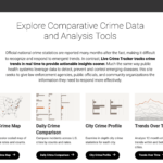
From a NORC Announcement: A first-of-its-kind data tracker from NORC at the University of Chicago’s Center on Public Safety and Justice offers in-depth information on crime, violence, and victimization in cities across the United States. The Live Crime Tracker provides the public—along with policymakers, researchers, and others—with transparent, timely, and available data that can help cities respond rapidly […]
The Brubeck Collection at Wilton Library Launches Digital Archive of Jazz Legend Dave Brubeck on International Jazz Day, 22,000+ Item Collection Includes Unreleased Music, Interactive Tour Maps, Song Timelines, Rare Photos, Videos & More
| Archives and Special Collections, Awards, Digital Collections, Digital Preservation, Libraries, Maps, News

From The Wilton Library: Today, one of the world’s premier jazz archives, The Brubeck Collection at Wilton Library (Wilton, CT), announced the launch of its enhanced and interactive digital archive, making the 22,000+ item collection catalog easily searchable and browsable online for the first time to everyone worldwide. This new digital archive also includes more […]
Copim’s Experimental Publishing Group Announces the Launch of Three Experimental Book Pilot Projects
| Companies (Publishers/Vendors), Funding, Maps, News, Publishing

Copim: A community working to build a fairer, more open future for scholarly books has just announced the launch of three experimental book publishing pilot projects. 1) Launch of Experimental Book Publishing Pilot Project ‘Servpub – A Collective Infrastructure to Serve and Publish’ The Open Book Futures (OBF) Experimental Publishing Group is pleased to announce […]
Funding: NEH Announces $26.2 Million for 238 Humanities Projects Nationwide
| Archives and Special Collections, Associations and Organizations, Awards, Data Files, Digital Collections, Digital Preservation, Funding, Jobs, Libraries, Maps, News, Podcasts, Preservation, Public Libraries, Reports
From the National Endowment for the Humanities (NEH): The National Endowment for the Humanities (NEH) today announced $26.2 million in grants for 238 humanities projects across the country. Grants awarded today will underwrite a new permanent exhibition at the Carnegie Museum of Natural History in Pittsburgh on how the Nile River shaped ancient Egyptians’ ideas of […]
NARA: National Archives Unveils New Mass Digitization Center in College Park
| Archives and Special Collections, Digital Preservation, Maps, News
From a National Archives and Records Administration (NARA) Post: A new state-of-the-art digitization center at the National Archives and Records Administration (NARA) in College Park, Maryland, is allowing the agency to provide greater public access to the country’s most important historical federal government records faster than ever before. Maryland Senator Chris Van Hollen, Representative Steny […]
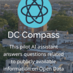
From Planetizen: Washington, D.C. recently launched a generative AI tool trained on 2,000 open data sets, reports Jonathan Andrews for Cities Today. The beta version of DC Compass, a chatbot similar to ChatGPT, is now accessible to city staff and residents to ask data-oriented civic questions and generate maps at a keystroke. The city worked with Esri, […]
