Research Tools: National Geographic Society and Utrecht University Launch World Water Map
From the National Geographic Society:
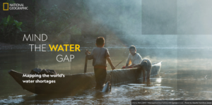
Today, the National Geographic Society launched the World Water Map as part of its five-year World Freshwater Initiative to better understand developing freshwater shortages around the world and inspire sustainable action. The Map was created by the National Geographic Society in cooperation with Utrecht University and Esri to identify water availability hotspots, visualize global freshwater supply and demand, and tell the story of how people use water. The Map is based on one of the most advanced open-source models to track water availability in every part of the world.
The Map provides an interactive view of the sectors of water use; how much water people consume for agricultural, industrial, and household use; and what’s left for nature. The Map, which builds on hydrological models made by Utrecht University, consists of over 40 years of historical data and will be updated periodically to monitor changes in water availability and demand.
[Clip]
Through the World Water Map, users can also search for their local watershed (zooming in up to 10 kilometers) to understand freshwater availability, demand, and sustainability issues affecting their community, and any given region in the world.
Learn More, Read the Complete Release
Direct to World Water Map
Filed under: Data Files, News, Patrons and Users
About Gary Price
Gary Price (gprice@gmail.com) is a librarian, writer, consultant, and frequent conference speaker based in the Washington D.C. metro area. He earned his MLIS degree from Wayne State University in Detroit. Price has won several awards including the SLA Innovations in Technology Award and Alumnus of the Year from the Wayne St. University Library and Information Science Program. From 2006-2009 he was Director of Online Information Services at Ask.com.
ADVERTISEMENT
Archives

ADVERTISEMENT