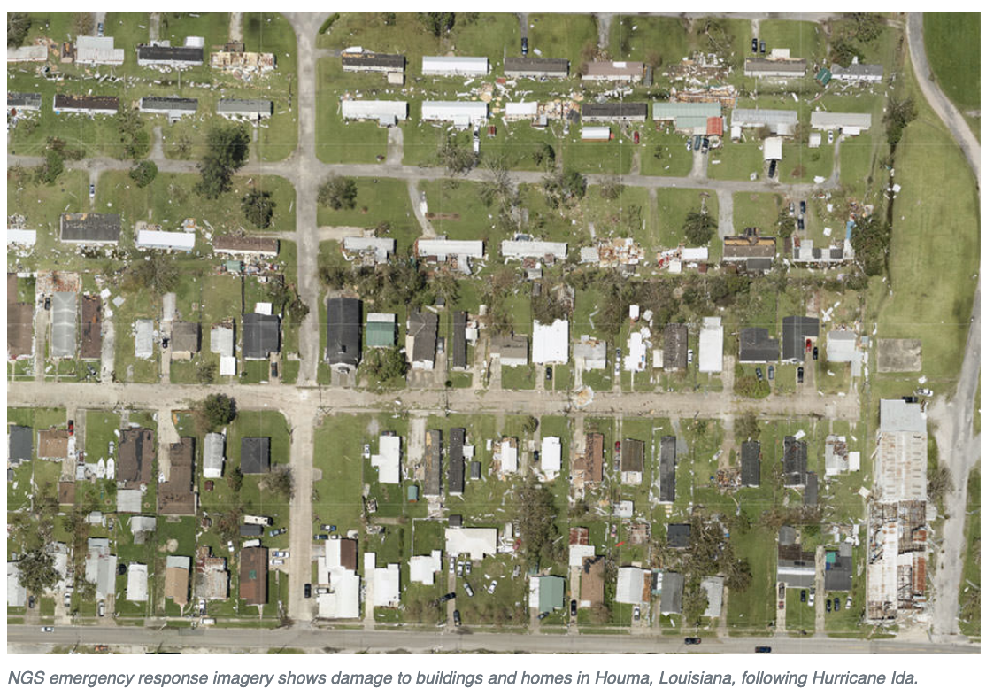
Hurricane Ida: National Geodetic Survey Begins Collecting and Sharing Emergency Response Imagery Online
From the National Ocean Service:
On August 30, the National Geodetic Survey (NGS) began collecting aerial images in the aftermath of Hurricane Ida. Imagery is being collected in specific areas identified by NOAA in coordination with FEMA and other state and federal partners. Collected images are available to view online via the NGS aerial imagery viewer. View tips and a video on how to use the imagery viewer.
[Clip]
NOAA’s aerial imagery aids safe navigation and captures damage to coastal areas caused by a storm. Aerial imagery is a crucial tool to determine the extent of the damage inflicted by flooding, and to compare baseline coastal areas to assess the damage to major ports and waterways, coastlines, critical infrastructure, and coastal communities. This imagery provides a cost-effective way to better understand the damage sustained to both property and the environment.
Direct to Complete Announcement
Filed under: News
About Gary Price
Gary Price (gprice@gmail.com) is a librarian, writer, consultant, and frequent conference speaker based in the Washington D.C. metro area. He earned his MLIS degree from Wayne State University in Detroit. Price has won several awards including the SLA Innovations in Technology Award and Alumnus of the Year from the Wayne St. University Library and Information Science Program. From 2006-2009 he was Director of Online Information Services at Ask.com.


