Research Tools: Conservation: Commonwealth of Virginia Launches ConserveVirgnia “Smart Map”
From The Roanoke Star:
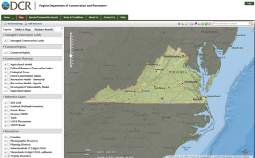
The Commonwealth of Virginia has officially launched ConserveVirginia, Virginia’s first in the nation, data-driven, statewide, land conservation strategy that identifies high value lands and conservation sites across the Commonwealth of Virginia.
ConserveVirginia’s living “smart map” is the synthesis of 19 mapped data inputs, divided into six categories, each representing a different overarching conservation value. The categories are: Agriculture & Forestry; Natural Habitat & Ecosystem Diversity; Floodplains & Flooding Resilience; Cultural & Historic Preservation; Scenic Preservation; and Protected Landscapes Resilience.
[Clip]
The ConserveVirginia map is designed to be updated regularly as new data becomes available and additional resources and protection tools emerge. Similarly, the administration will work to add new data models to the ConserveVirginia map as data and technology allow. For example, future maps will identify high nutrient and sediment load areas in need of conservation and restoration to protect and restore the Chesapeake Bay water quality.
Direct to ConserveVirginia SmartMap
Learn More, Read the Complete Article
Filed under: Data Files, Maps, News, Preservation
About Gary Price
Gary Price (gprice@gmail.com) is a librarian, writer, consultant, and frequent conference speaker based in the Washington D.C. metro area. He earned his MLIS degree from Wayne State University in Detroit. Price has won several awards including the SLA Innovations in Technology Award and Alumnus of the Year from the Wayne St. University Library and Information Science Program. From 2006-2009 he was Director of Online Information Services at Ask.com.


