Research/Reference Tools: University of Wisconsin-Madison Debuts First-of-Its Kind Neighborhood Map to Guide Medical Decision-Making
From the University of Wisconsin-Madison:
Socio-economic factors can affect health in surprising ways.
For example: A doctor prescribes insulin for a diabetic patient, but doesn’t ask if the patient has a refrigerator in which to store it. The patient lives in a neighborhood with substandard housing conditions, and a working refrigerator or electricity isn’t a given. The insulin spoils and doesn’t control the patient’s blood sugar.A new map of neighborhood disadvantage may help better address that kind of problem while boosting research into the social factors that shape health.
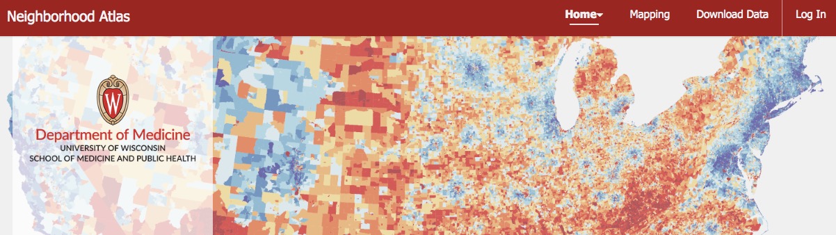
Researchers at the University of Wisconsin School of Medicine and Public Health have developed an accessible, online, interactive map of more than 70 million Zip+4 zip codes so that users can find data on socio-economic factors at the neighborhood level.
The Neighborhood Atlas helps quantify the degree of disadvantage in a given area – a factor increasingly viewed as critical to assessing health disparities and effective interventions.
[Clip]
The map is based on the Area Deprivation Index (ADI), a measure created by the Health Resources and Services Administration many years ago for use on larger geographic areas and based on census data. Kind’s research group has modernized and refined the ADI down to the neighborhood level for all of the neighborhoods within the United States and Puerto Rico.
Furthermore, they have constructed an interactive map and made the information easily accessible to all users and mergeable into many other data resources. The ADI includes four areas: unemployment, poverty, education and housing and includes multiple measures of each area to yield a picture of a given area’s socio-economic disadvantage.
[Clip]
There is a map for each state and Puerto Rico. One can rank a given state on its own metrics or compared with the national average. Kind says the data housed by the Neighborhood Atlas is already being used by state and federal agencies and health systems; for example, a national diabetes disparities program run by U.S. Centers for Medicare and Medicaid Services is using Neighborhood Atlas ADI data to inform ground-level operations so the program can be targeted to areas that will most benefit from it.
Direct to The Neighborhood Atlas (Interactive and PDF Maps)
Learn More, Read the Complete UW-Madison Launch Announcement
Direct to Journal Article: Making Neighborhood-Disadvantage Metrics Accessible — The Neighborhood Atlas (via NEJM)
Filed under: Data Files, Maps, News, Patrons and Users
About Gary Price
Gary Price (gprice@gmail.com) is a librarian, writer, consultant, and frequent conference speaker based in the Washington D.C. metro area. He earned his MLIS degree from Wayne State University in Detroit. Price has won several awards including the SLA Innovations in Technology Award and Alumnus of the Year from the Wayne St. University Library and Information Science Program. From 2006-2009 he was Director of Online Information Services at Ask.com.
ADVERTISEMENT
Archives

ADVERTISEMENT