New Interactive Map: New York City Regional Data Explorer Launches Online
From Gotham Gazette:
Metro Region Explorer [is] an interactive online tool created by DCP’s Planning Labs unit that allows public access to regional economic, housing, and population data and trends.
In Their Own Words
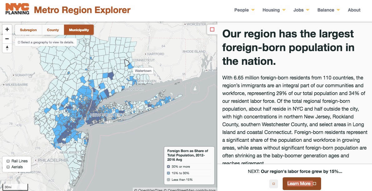
Metro Region Explorer is an interactive map showing population, housing, and employment trends within the tri-state New York City metropolitan region, and shares key insights about how the region has changed from 2000 to today.
Developed in collaboration between DCP Planning Labs and DCP Regional Planning, this tool will be maintained as part of our ongoing commitment to help the public access and understand information about planning issues affecting NYC and the metro region.
Using data from a range of publicly available sources, the Metro Region Explorer allows you to view socioeconomic characteristics across 7 subregions, 31 counties, and nearly 900 municipalities.
Direct to Methodology and to Download Underlying Data Files
Direct to Metro Region Explorer
NOTE: About one month ago DCP Planning Labs released another useful interactive data tool, New York City Population FactFinder (NYC PFF).
UPDATED May 24, 2018
Additional Coverage From Rachel Kaufman/City Lab: “New York City Debuts Regional Mapping Tool”
Filed under: Data Files, News
About Gary Price
Gary Price (gprice@gmail.com) is a librarian, writer, consultant, and frequent conference speaker based in the Washington D.C. metro area. He earned his MLIS degree from Wayne State University in Detroit. Price has won several awards including the SLA Innovations in Technology Award and Alumnus of the Year from the Wayne St. University Library and Information Science Program. From 2006-2009 he was Director of Online Information Services at Ask.com.
ADVERTISEMENT
Archives

ADVERTISEMENT