Research Tools: Mapping Public Lands in the United States (Protected Areas Database of the United States (PAD-US)
From the USGS:
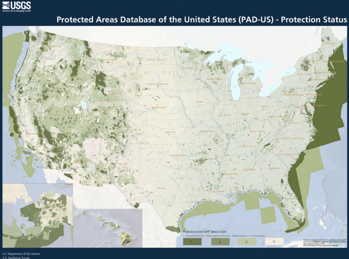
The Protected Areas Database of the United States (PAD-US) is the official inventory of public parks and other protected areas in all U.S. states and territories.
The growing database contains more than three billion public land and marine acres managed by nearly 15,100 agencies and nongovernmental organizations, covering 200,000 separate parks and protected areas. PAD-US is a product of Core Science Analytics, Synthesis, and Library (CSAS&L) in the USGS Core Science Systems Mission Area.
[Clip]
What can you do with PAD-US?
Explore the different types of public lands in the United States. National, state, regional, and local organizations all manage protected lands. From the PAD-US map you can identify protected areas managed by various federal agencies such as the Bureau of Land Management, the U.S. Forest Service, and the National Park Service. Or you can view information for recreational areas such as State Parks.
Read the Complete Introduction to the Protected Areas Database of the United States (PAD-US)
Direct to Protected Areas Database of the United States (PAD-US)
See Also: PAD-US—National Inventory of Protected Areas Fact Sheet
2 pages; PDF (Revised August 4, 2017)
See Also: Completing America’s Inventory of Public Parks and Protected Areas (via USGS)
60 pages; PDF.
Filed under: Associations and Organizations, Management and Leadership, News
About Gary Price
Gary Price (gprice@gmail.com) is a librarian, writer, consultant, and frequent conference speaker based in the Washington D.C. metro area. He earned his MLIS degree from Wayne State University in Detroit. Price has won several awards including the SLA Innovations in Technology Award and Alumnus of the Year from the Wayne St. University Library and Information Science Program. From 2006-2009 he was Director of Online Information Services at Ask.com.
ADVERTISEMENT
Archives

ADVERTISEMENT