SUBSCRIBE
SUBSCRIBE
EXPLORE +
  • About infoDOCKET
  • Academic Libraries on LJ
  • Research on LJ
  • News on LJ
  • Skip to primary navigation
  • Skip to main content
  • Skip to primary sidebar
  • Libraries
    • Academic Libraries
    • Government Libraries
    • National Libraries
    • Public Libraries
  • Companies (Publishers/Vendors)
    • EBSCO
    • Elsevier
    • Ex Libris
    • Frontiers
    • Gale
    • PLOS
    • Scholastic
  • New Resources
    • Dashboards
    • Data Files
    • Digital Collections
    • Digital Preservation
    • Interactive Tools
    • Maps
    • Other
    • Podcasts
    • Productivity
  • New Research
    • Conference Presentations
    • Journal Articles
    • Lecture
    • New Issue
    • Reports
  • Topics
    • Archives & Special Collections
    • Associations & Organizations
    • Awards
    • Funding
    • Interviews
    • Jobs
    • Management & Leadership
    • News
    • Patrons & Users
    • Preservation
    • Profiles
    • Publishing
    • Roundup
    • Scholarly Communications
      • Open Access

June 4, 2019 by Gary Price

Research Tools: The National Map—New Data Delivery Homepage, Advanced Viewer, Lidar Visualization

June 4, 2019 by Gary Price

From a USGS Fact Sheet:

As one of the cornerstones of the U.S. Geological Survey’s (USGS) National Geospatial Program, The National Map is a collaborative effort among the USGS and other Federal, State, and local partners to improve and deliver topographic information for the Nation.

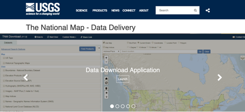
The National Map is featuring direct links to new and improved GIS data access utilities on a refreshed data delivery homepage at https://www.usgs.gov/NationalMap/data.

The following is a list of some of the capabilities available through the National Map applications.

•Create and export maps using The National Map’s online data. Even import your own data into the viewer for display and map creation.

• Search or browse The National Map’s extensive data catalog and select from several methods for downloading.

• Find and explore lidar point clouds in 3D through the Lidar Explorer.

•Access current and historical topo maps available in GeoPDF and GeoTIFF formats.

Direct to Complete Fact Sheet 
2 pages; PDF.

Filed under: Data Files, Maps, News

SHARE:

About Gary Price

Gary Price (gprice@gmail.com) is a librarian, writer, consultant, and frequent conference speaker based in the Washington D.C. metro area. He earned his MLIS degree from Wayne State University in Detroit. Price has won several awards including the SLA Innovations in Technology Award and Alumnus of the Year from the Wayne St. University Library and Information Science Program. From 2006-2009 he was Director of Online Information Services at Ask.com.

ADVERTISEMENT

Archives

Job Zone

ADVERTISEMENT

Related Infodocket Posts

ADVERTISEMENT

FOLLOW US ON X

Tweets by infoDOCKET

ADVERTISEMENT

This coverage is free for all visitors. Your support makes this possible.

This coverage is free for all visitors. Your support makes this possible.

Primary Sidebar

  • News
  • Reviews+
  • Technology
  • Programs+
  • Design
  • Leadership
  • People
  • COVID-19
  • Advocacy
  • Opinion
  • INFOdocket
  • Job Zone

Reviews+

  • Booklists
  • Prepub Alert
  • Book Pulse
  • Media
  • Readers' Advisory
  • Self-Published Books
  • Review Submissions
  • Review for LJ

Awards

  • Library of the Year
  • Librarian of the Year
  • Movers & Shakers 2022
  • Paralibrarian of the Year
  • Best Small Library
  • Marketer of the Year
  • All Awards Guidelines
  • Community Impact Prize

Resources

  • LJ Index/Star Libraries
  • Research
  • White Papers / Case Studies

Events & PD

  • Online Courses
  • In-Person Events
  • Virtual Events
  • Webcasts
  • About Us
  • Contact Us
  • Advertise
  • Subscribe
  • Media Inquiries
  • Newsletter Sign Up
  • Submit Features/News
  • Data Privacy
  • Terms of Use
  • Terms of Sale
  • FAQs
  • Careers at MSI


© 2026 Library Journal. All rights reserved.


© 2022 Library Journal. All rights reserved.