Reference: FCC Releases Updated and Improved National Broadband Deployment Map
From Mapbox:
Today, the FCC launched a new National Broadband Map, allowing Americans to inspect broadband provider availability in every county, city, and even neighborhood across the U.S.
For this map, the FCC needed to display a massive amount of data on broadband availability and broadband speeds across the US, down to the neighborhood level. It needed to be interactive, so that Americans can understand what broadband coverage is available to them, and where there are still areas of no broadband options that the FCC needs to address.
[Clip]
The map displays an FCC dataset with over 68 million records, across 11 million blocks, with 441 different broadband providers — this makes for nearly 5 billion vector combinations. Once a user adds in their address, they can see the broadband providers available for their home along with provider tech and speeds. Users can interact with the map at all levels, starting from visualizing coverage in their neighborhood or block and drilling all the way up to nationwide view.
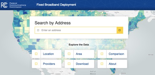 From the FCC’s Announcement
The new, cloud-based map will support more frequent data updates and display improvements at a far lower cost than the original mapping platform, which had not been updated in years.
Improvements and features in the successor National Broadband Map include:
- Fixed deployment data based on the latest collection by the FCC and updated twice annually
- Deployment summaries available for seven different geographical types: nation, state, county, congressional district, city or town (census place), Tribal area, and Core -based Statistical Area (such as New York-Newark-Jersey City NY-NJ-PA)
- Broadband availability and provider counts in each of the nation’s over 11 million census blocks, available for six technologies (fiber, DSL, cable, satellite, fixed wireless, and other) as well as seven speeds, for a total of 441 combinations
- Provider summary information available for 1,782 providers by technology, eight download speed tiers, and nine upload speed tiers
- Deployment comparisons between geographic areas
- A portal for data downloads
- Satellite imagery map overlay that shows buildings, roads, and geography
- Graphs that show what fraction of an area’s population has access to broadband at a given speed
Direct to National Broadband Map
Filed under: Data Files, News, Patrons and Users
About Gary Price
Gary Price (gprice@gmail.com) is a librarian, writer, consultant, and frequent conference speaker based in the Washington D.C. metro area. He earned his MLIS degree from Wayne State University in Detroit. Price has won several awards including the SLA Innovations in Technology Award and Alumnus of the Year from the Wayne St. University Library and Information Science Program. From 2006-2009 he was Director of Online Information Services at Ask.com.
ADVERTISEMENT
Archives

ADVERTISEMENT