In 2013, we released Google Earth Timelapse, our most comprehensive picture of the Earth’s changing surface. This interactive experience enabled people to explore these changes like never before—to watch the sprouting of Dubai’s artificial Palm Islands, the retreat of Alaska’s Columbia Glacier, and the impressive urban expansion of Las Vegas, Nevada.
Today, we’re making our largest update to Timelapse yet, with four additional years of imagery, petabytes of new data, and a sharper view of the Earth from 1984 to 2016.
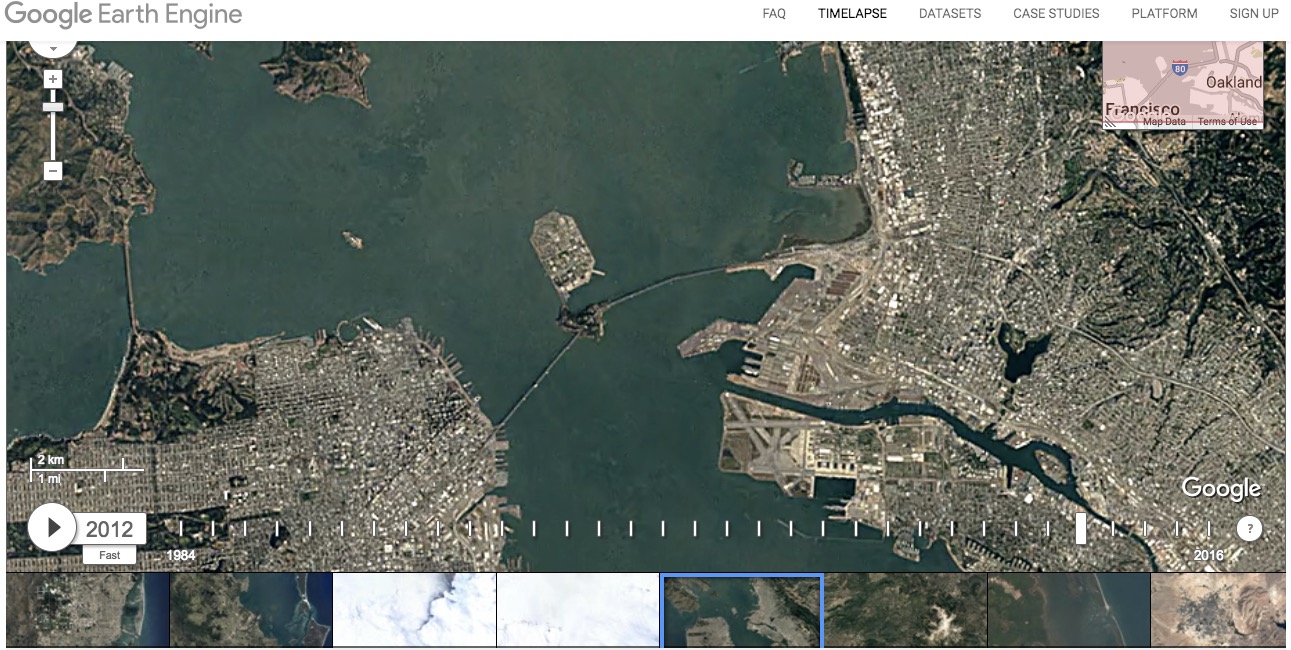
We’ve even teamed up again with our friends at TIME to give you an updated take on compelling locations. Google Timelapse (SF Bay Area, 2012)
[Clip]
To view the new Timelapse, head over to the Earth Engine website.
You can also view the new annual mosaics in Google Earth‘s historical imagery feature on desktop, or spend a mesmerizing 40 minutes watching thisYouTube playlist.
Gary Price (gprice@gmail.com) is a librarian, writer, consultant, and frequent conference speaker based in the Washington D.C. metro area.
He earned his MLIS degree from Wayne State University in Detroit.
Price has won several awards including the SLA Innovations in Technology Award and Alumnus of the Year from the Wayne St. University Library and Information Science Program. From 2006-2009 he was Director of Online Information Services at Ask.com.